


Tête de l'Aupet

oliviergau
User

Length
15.4 km

Max alt
2583 m

Uphill gradient
1330 m
Km-Effort
33 km

Min alt
1217 m

Downhill gradient
1344 m
Boucle
Yes
Creation date :
2019-03-01 09:24:10.203
Updated on :
2019-03-01 15:54:10.896
6h26
Difficulty : Very easy

FREE GPS app for hiking
 SityTrail
IGN / Geographical institutes
SityTrail Plus
The world is yours!
About
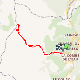
Trail Touring skiing of 15.4 km to be discovered at Provence-Alpes-Côte d'Azur, Hautes-Alpes, Le Dévoluy. This trail is proposed by oliviergau.
Positioning
Country:
France
Region :
Provence-Alpes-Côte d'Azur
Department/Province :
Hautes-Alpes
Municipality :
Le Dévoluy
Location:
Saint-Disdier
Start:(Dec)
Start:(UTM)
728047 ; 4955935 (31T) N.
Comments